


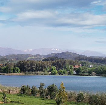
Sougia - Lissos
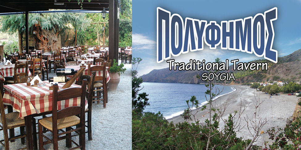
Sougia, tel: +3028230-51343, e-mail: polifimos@gmx.net, Open April to October. The best place to try the real homemade Cretan cuisine in a garden full of plants and flowers. A wide variety of dishes, fresh ingredients, fresh meat, kontosouvli, food cooked in olive oil in the stewpot or in the oven, excellent wine, holiday atmosphere and very good service till late at night.
Sougia, tel: +3028230-51343, e-mail: polifimos@gmx.net, Open April to October. The best place to try the real homemade Cretan cuisine in a garden full of plants and flowers. A wide variety of dishes, fresh ingredients, fresh meat, kontosouvli, food cooked in olive oil in the stewpot or in the oven, excellent wine, holiday atmosphere and very good service till late at night.
We Recoment
A wonderful trip crossing the mountain range in the borough of Hania and ends at the Libyan sea.
AGHIA The name probably comes from the Arabic word "αthα" meaning water, due to the many rich springs in the area. The village existed during the Arab occupation, but particularly flourished in the second Byzantine period (after the 8th century) when the Diocese of Kydonia had been transferred there for security reasons. During the Second World War, a number of very tough battles between the allies and the Germans took place there during the course of the German invasion of Crete.
ALIKIANOS It is worth our while to see the Byzantine church of St George and the ruins of the historical castle Da Molin, (where it is said the well-known tragedy of the Cretan Marriages took place according to Zambelios - 1813-1881). Continuing on our way we come to the very green villages of Skines, Prasses and Sembrona, which are on the border between the province of Kithonia and Selinos. After Sembrona on the 38th kilometer, there is a road that branches off and leads us to Omalos.
St. IRENE. A little way out of the village, we encounter one of the most important gorges of western Crete, 8 kilometers long and 450-500 meters deep. Overgrown and cool it provides many at- tractions for walkers. Continuing on our way we come across Epanohori, Prineas, Tsiskiana and we reach the main village Kambanou. Immediately afterwards we arrive at Rodovani where we come across the Byzantine church- es of St Paraskevi, St George, St John and of the Virgin Mary. East of Rodovani on Kephalla Hill is the ancient Elyros, the most important Dorian town of western Crete, whose port is today’s Sougia. It was Pashley (an English traveler) who first determined the position of Elyros. An inscription, which was found later, confirmed Pashley’s view. The topo- graphic name is derived from the word Ekliro= liquid. In 1834, Pashley observed a large edifice, which must have been the temple of Apollo, who was worshipped in Elyros, as well as parts of fortified walls, relics of the Greco-Roman reservoir and traces of a theatre. On the ruins of the ancient temple, the Byzantine church of the Virgin Mary is built on top of the ancient mosaic floor. Elyros maintained its activities in the Roman and the first Byzantine periods (until the 9th century A.D.). West of Rodovani and about 5 kilometers away we come across the ancient town Irtakina (outside the village Temenia). Its name is pre-Hellenic and it is considered a colony of Achaei. Thenon (a French traveler) believes that it was the capital of Achaei in Western Crete and that it was destroyed by the Dorians. It was surrounded by two rows of impenetrable cyclopean walls whose remains can still be seen today. It was a fortress town with its own currency some coins with the Cretan mountain goat and the bee and others with the dolphin and 8 spoke star. Elyros, Irtakina, Lissos and Tarra had contracted a numismatic union and used the same currency. Irtakina is mentioned amongst the Cretan towns, which signed the treaty with Eumenis of Pergamos in 170 B.C.

SOUGIA. The ancient Siyia, haven of Elyros. The name probably originates from the word “sis" = pig, namely pig town. It appears that there were forests of oak and holly trees, and there was a systematic rearing of pigs. The waterfall bed of Lakkou Zografou divided the still remaining ruins of the old town into two parts. On the western side, there was a well-defended port that has disappeared today due to the geological rise of western Crete. The greatest part of Siyia was on the west where, even today, we can see reservoirs, relics of ancient buildings, hot springs and parts of city walls. The ancient town flourished both in Roman times and during the Byzantine period. We also come across the ruins of three large early Christian Basilica churches. One im- portant early Christian Basilica was recently discovered on which a contemporary church has been built. What has survived from the early Christian Basilica is the three-aisled temple and the vestibule where you can see the very beautiful mosaic floors with representations of geometric shapes and animals framed by ivy petals. The town was destroyed by the Saracens. East of Sougia is the famous Gorge of Tripiti, with a beautiful bay at the exit of the ravine.
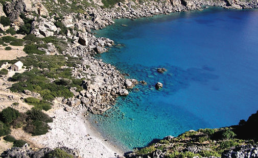
LISSOS. West of Sougia (a one and a half hour walk or a twenty minute boat ride) is the ancient seaside town Lissos, famous for its curative springs. It is the only town in Western Crete, together with Irtakina, where they had cut gold coins with the head of Diana and the dolphin and the word Lission. It is worth visiting the Askle-
pion temple of Dorian style, where many statues were discovered a few in the original size of Asklepios of Eyias (Health) of Pluto, as well as many inscribed pedestals of statues, which mention being offerings to Asklepios or to Eyia. The floor is a mosaic with fine multicolored pebbles of complex geometric shapes and pictures of animals. Lissos had a reservoir, a theatre and hot springs during Roman times which have not been excavated yet. It flourished in the Hellenistic, but mainly in the Roman period and in the Byzantine era. From the Byzantine period, we have the ruins of two early Christian basilicas with mosaic floors where today stand the chapels of the Virgin Mary and St Kirkos (St Kyriakos).

